Georg and Hogenberg, Franz Braun Paintings
Georg Braun and Franz Hogenberg were pivotal figures in the field of cartography and printmaking in the 16th century, known primarily for their collaborative work on the 'Civitates Orbis Terrarum', a monumental city atlas that constitutes one of the most significant achievements in the history of cartography. Georg Braun, born in 1541, was a German cleric and editor who conceived the idea for the atlas. Franz Hogenberg, born around 1535, was a German engraver and artist. Together, they embarked on a project that would visually document the urban landscapes of the world with unprecedented detail and accuracy.
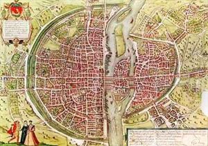
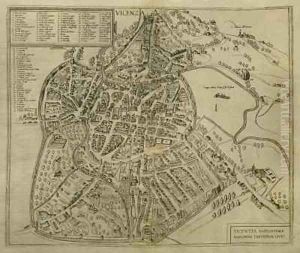
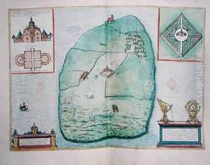
The 'Civitates Orbis Terrarum', or 'Cities of the World', was published in six volumes between 1572 and 1617, long after Hogenberg's death; work on the final volumes was continued by Hogenberg's son, Abraham. This grand atlas comprised over 500 maps and views of cities from all around the globe, including Europe, Asia, Africa, and Latin America. The collaboration between Braun, who wrote the descriptions of the cities, and Hogenberg, who was responsible for the engravings, produced a work that was not only a marvel of cartography and art but also an invaluable resource for historical and cultural studies.
The detailed plates of the 'Civitates' provide a window into the Renaissance world, showcasing the architecture, urban planning, and daily life of the period. Each plate was based on drawings and paintings created by artists who had visited the cities, making the 'Civitates' one of the first attempts to systematically document the world's urban landscapes. The atlas was immensely popular in its time, catering to the burgeoning interest in geography and exploration during the Renaissance.
Georg Braun's role as the editor and text author of the 'Civitates Orbis Terrarum' was to compile and synthesize information about each city, providing historical and cultural context to accompany Hogenberg's engravings. Braun's work ensured that the 'Civitates' was not just a collection of images but a comprehensive guide to the world's urban centers. Franz Hogenberg's death in 1588 marked the end of his direct contributions to the project, while Georg Braun continued to oversee the publication of the atlas until his death in 1622.
Though other artists and engravers contributed to the 'Civitates Orbis Terrarum' after Hogenberg's death, the foundational work by Braun and Hogenberg laid the groundwork for the atlas's enduring legacy. Their collaboration represents a remarkable fusion of art and science, capturing the spirit of exploration and curiosity that defined the Renaissance. Today, the 'Civitates Orbis Terrarum' remains a testament to their vision and craftsmanship, offering historians, geographers, and art enthusiasts a precious glimpse into the past.


