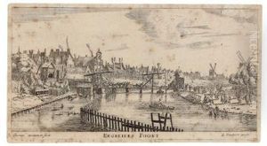
Cornelius I Danckerts Paintings
Cornelius I Danckerts, often simply referred to as Cornelius Danckerts, was a Dutch engraver and cartographer born in 1561 in the city of Antwerp, which at the time was part of the Spanish Netherlands. He was a member of the prominent Danckerts family, which included several generations of engravers, publishers, and cartographers. Cornelius was a contemporary of the more famous mapmakers from the Golden Age of Dutch cartography, such as Willem Blaeu and Jodocus Hondius.
Danckerts' work in cartography was significant during a period when the Dutch Republic was at the forefront of trade and exploration, and thus mapmaking was a highly respected and lucrative profession. Cornelius I Danckerts is known to have contributed to the production of maps and atlases, which would have been used for navigation and trade, as well as for educational purposes. His works would have included detailed maps of European countries, as well as parts of the newly explored world.
Despite his contributions, Cornelius I Danckerts is not as well-documented as some of his peers. Records of his life are relatively scarce, and many of his works may have been published without attribution or have been attributed to the Danckerts family as a whole. As a result, his individual contributions to cartography are not as clearly defined as those of some other mapmakers of his time.
Cornelius I Danckerts passed away in 1634. Although he may not have achieved the same level of fame as some of his contemporaries, his work nonetheless played a role in the rich tapestry of Dutch cartography during its most celebrated period. The Danckerts family continued to influence the world of mapmaking and publishing, with Cornelius' descendants maintaining the family tradition well into the 18th century.
