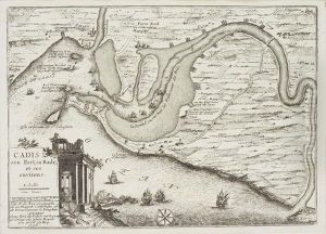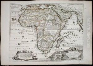


Well-engraved And Attractive Map Of Africa, Filled With "legends" Describing The Natives And Geography Of The Region, And The Birds And Beasts; Ptolemy's Lakes Of Zaire And Zaflan Are Shown Entirely Divorced From The Nile. There Is A Large Pictorial Carto
-
About Reproduction
Discover the allure of art with our faithful reproduction of "Well-engraved And Attractive Map Of Africa, Filled With "legends" Describing The Natives And Geography Of The Region, And The Birds And Beasts; Ptolemy's Lakes Of Zaire And Zaflan Are Shown Entirely Divorced From The Nile. There Is A Large Pictorial Carto", originally brought to life by the talented Nicolas de Fer. Unlike posters or prints, our hand-painted oil painting breathes an unique sense of depth and texture into your space. Every detail, every stroke, and every texture is meticulously recreated, paying the perfect homage to Nicolas de Fer and his artistic vision.
Owning this piece is more than just decoration - it's a statement of your refined taste in art. Let the vibrant colors and intricate details of this replica serve as a daily reminder of the beauty in our world. Elevate your decor and appreciate the richness of art with our replica of this masterpiece.
-
Painting Description
Nicolas de Fer's "Well-engraved And Attractive Map Of Africa, Filled With 'legends' Describing The Natives And Geography Of The Region, And The Birds And Beasts; Ptolemy's Lakes Of Zaire And Zaflan Are Shown Entirely Divorced From The Nile. There Is A Large Pictorial Carto" is a notable cartographic work from the late 17th to early 18th century. De Fer, a prominent French cartographer and geographer, was renowned for his detailed and decorative maps, which often combined geographical information with artistic embellishments. This particular map of Africa is a testament to his skill and the cartographic knowledge of the time.
The map is distinguished by its intricate engravings and the inclusion of various "legends" that describe the indigenous peoples, geographical features, and the diverse fauna of the African continent. These legends provide a glimpse into the European perspective and understanding of Africa during that era, reflecting both the curiosity and the misconceptions of the time. The map is also notable for its depiction of Ptolemy's lakes, Zaire and Zaflan, which are shown completely separate from the Nile River. This representation diverges from the more commonly accepted geographical theories of the period, highlighting the evolving nature of cartographic knowledge and the influence of classical sources on early modern mapmaking.
In addition to its geographical content, the map is adorned with a large pictorial cartouche, a decorative element that often included allegorical figures, coats of arms, and other artistic motifs. This cartouche not only enhances the visual appeal of the map but also serves as a frame for the title and other pertinent information, making it a focal point of the composition.
Nicolas de Fer's map of Africa is a valuable historical document that offers insights into the cartographic practices and geographical knowledge of the late 17th and early 18th centuries. Its detailed engravings and rich legends make it an important piece for both historians and collectors of antique maps.
-
Lead Time & Shipping
When you order this oil painting replica, it typically takes 2-3 weeks to paint. If the artwork is more complex, it might need a little more time to ensure the best quality. Once it's ready, we'll send you a photo for your approval. After you give the green light, we'll ship it to you for free.
-
Return & Refund
We believe in the quality of our hand-painted oil painting reproductions, and your satisfaction is our priority. If for any reason, you are not completely satisfied with your purchase, we offer a 45-day return policy. You can return your artwork within 45 days of receipt and receive a full refund. Please note that the artwork must be returned in the original packaging and in the same condition as it was received.

