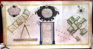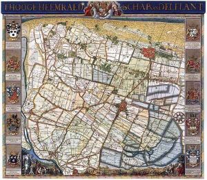


Map of Delfland 1750
-
About Reproduction
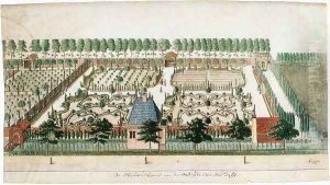
Discover the allure of art with our faithful reproduction of "Map of Delfland 1750", originally brought to life by the talented Nicolaas Samuel Cruquius. Unlike posters or prints, our hand-painted oil painting breathes an unique sense of depth and texture into your space. Every detail, every stroke, and every texture is meticulously recreated, paying the perfect homage to Nicolaas Samuel Cruquius and his artistic vision.
Owning this piece is more than just decoration - it's a statement of your refined taste in art. Let the vibrant colors and intricate details of this replica serve as a daily reminder of the beauty in our world. Elevate your decor and appreciate the richness of art with our replica of this masterpiece.
-
Painting Description
The "Map of Delfland 1750" is a historic cartographic masterpiece created by the Dutch land surveyor and water management specialist Nicolaas Samuel Cruquius (1678–1754). This detailed map represents the region of Delfland, which is part of the province of South Holland in the Netherlands, and is known for its intricate system of canals, dykes, and polders. Cruquius, whose real name was Nicolaas Kruik, was a pivotal figure in the development of early modern hydrology and land surveying techniques, and his work on the map of Delfland is considered one of his most significant contributions.
Completed in 1750, the map is a testament to the advanced state of Dutch cartography in the 18th century. It showcases not only the topography and hydrography of the area but also provides detailed insights into the land use, settlement patterns, and the sophisticated water management infrastructure that was crucial for preventing floods and reclaiming land from the sea. The map is often noted for its accuracy, scale, and the meticulous attention to detail, which was achieved through the use of pioneering surveying techniques of the time.
Cruquius's map was instrumental for local water boards in managing the water levels and for guiding the construction and maintenance of the region's water defenses. Today, it serves as an important historical record, offering a snapshot of the Delfland region's landscape in the mid-18th century. The map is not only of interest to historians and cartographers but also to those studying the development of Dutch civil engineering and environmental management.
The "Map of Delfland 1750" remains an enduring symbol of the ingenuity and precision of Dutch cartography, reflecting the interplay between human intervention and the natural landscape in one of the most water-challenged regions of the world. Its creation by Nicolaas Samuel Cruquius underscores his legacy as a pioneer in the field of hydraulic engineering and his lasting impact on the management of the Dutch waterways.
-
Lead Time & Shipping
When you order this oil painting replica, it typically takes 2-3 weeks to paint. If the artwork is more complex, it might need a little more time to ensure the best quality. Once it's ready, we'll send you a photo for your approval. After you give the green light, we'll ship it to you for free.
-
Return & Refund
We believe in the quality of our hand-painted oil painting reproductions, and your satisfaction is our priority. If for any reason, you are not completely satisfied with your purchase, we offer a 45-day return policy. You can return your artwork within 45 days of receipt and receive a full refund. Please note that the artwork must be returned in the original packaging and in the same condition as it was received.

